Satellite maps that go down to the bicycle.

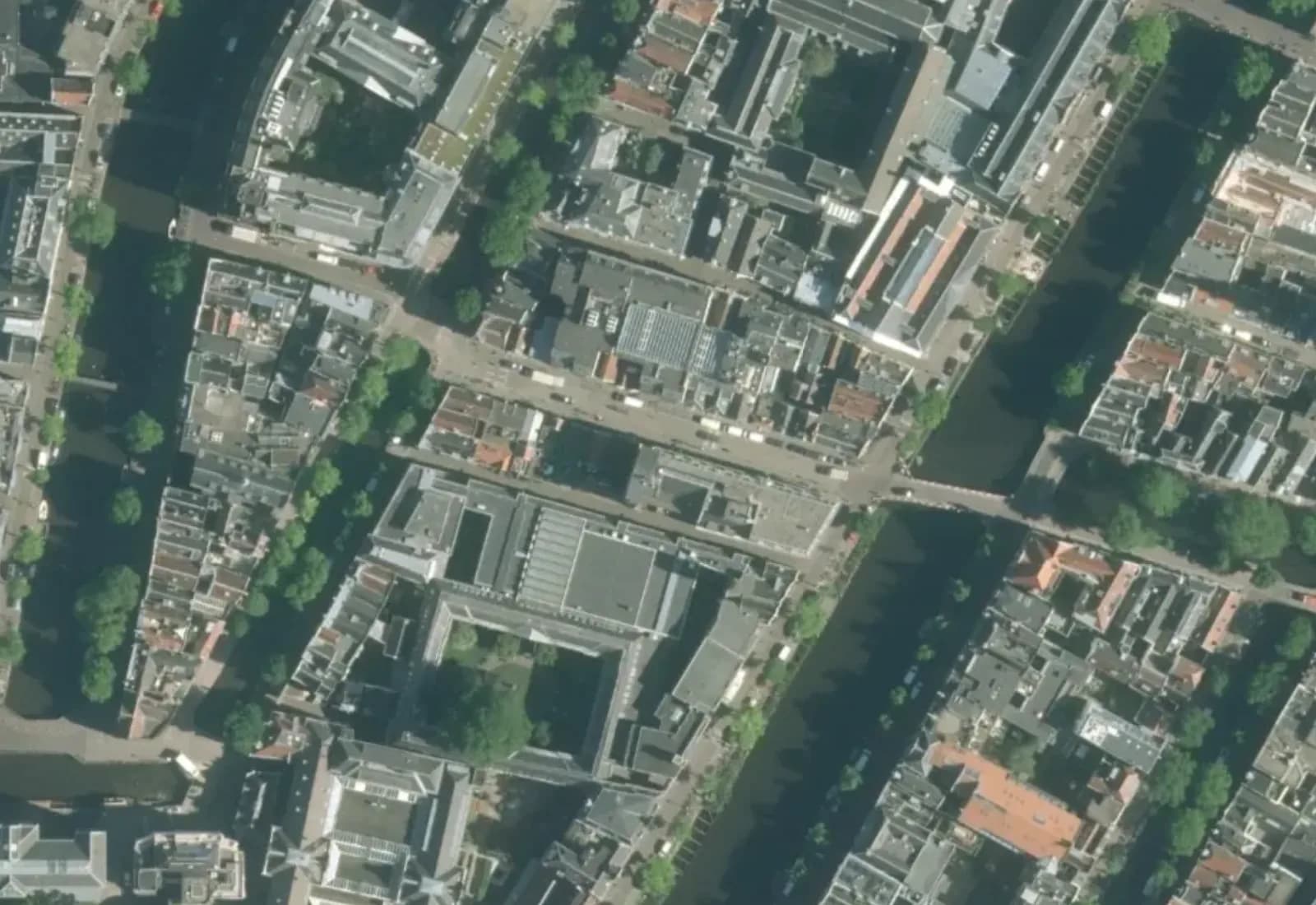
Worldwide satellite imagery, and at street zoom aerial photography sharp enough to count the bikes by the canal. Bare, or with roads and labels on top. The map is touring by itself; drag it to take over.

Where it lands in your product.

Nobody ships an imagery stack. They ship a listing where the buyer sees the roof, a farm dashboard with the field boundaries drawn on the crop, a port map where the terminal is a terminal. This is what Satellite looks like from the outside.

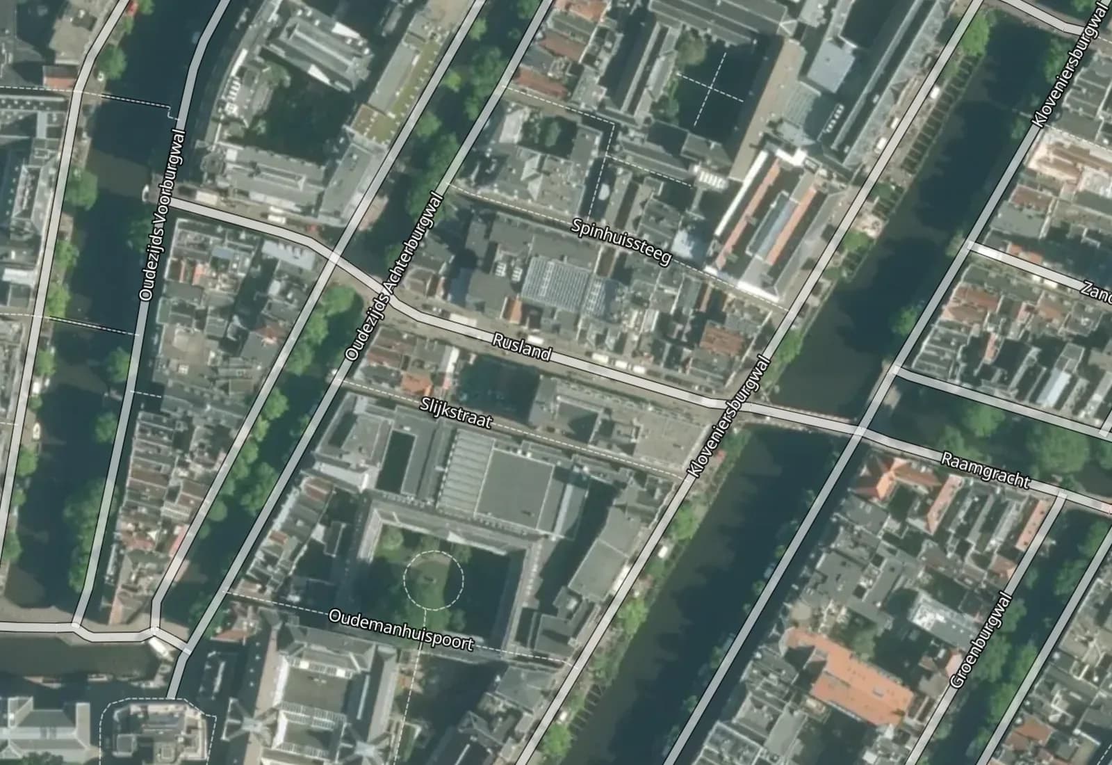
Imagery, or imagery with the map on top.

Satellite is the bare picture. Hybrid draws roads, boundaries and labels over it, restyled to stay legible on photography. Same session, same camera, one style name apart.

Relief on top of it
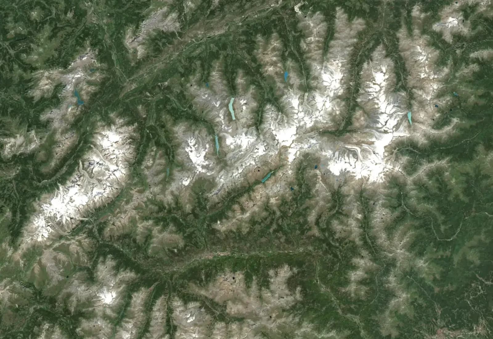
The Alps in the Satellite style at zoom 8
The Alpszoom 8worldwide mosaic

Two sources, one zoom.

Worldwide satellite imagery from a mountain range down to a city block, and where we carry aerial photography a hand-over at street zoom to pictures sharp enough to count the bicycles.

The vector map underneath

One map session, imagery switched on and off

  1. Streets map opensno extra unit
1unit, imagery included

same session as Streets
same monthly pool

Imagery costs nothing extra.

The imagery archives are signed into the same map session as the basemap. Switch to Satellite, zoom into the aerial, turn Hybrid on and off: still one unit.

See what a month costs
imagery.ts
import { Map, MapStyle } from '@rijwind/sdk';

const map = new Map({
  container: 'map',
  style: MapStyle.HYBRID, // or SATELLITE for bare imagery
  center: [4.8952, 52.3702], zoom: 17,
});

map.setStyle(MapStyle.STREETS); // back to the vector map, same session

One style name, the whole stack.

Imagery is several rasters in a specific order: ocean and base under the mosaic, the aerial on top. The SDK opens it with a style name; bring your own MapLibre and the hosted style JSON already carries the stack.

Read the imagery guide

Imagery is in the session already.

Opening any map issues one short-lived session, and it signs the imagery archives alongside the basemap: the worldwide mosaic, the ocean and base layers under it, the aerial photography on top. Satellite and Hybrid just use them.

How sessions work, in the docs ↗
one map session
  1. {
  2. "url": "https://cdn.rijwind.com/tiles/planet.pmtiles?token=…&expires=1789039007",// the worldwide vector basemap, signed for this session; every Streets variant draws from it
  3. "terrainUrl": "https://cdn.rijwind.com/tiles/terrain.pmtiles?token=…&expires=1789039007",// elevation for hillshade, contours and 3D, in the same session at no extra unit
  4. "satelliteUrl": "https://cdn.rijwind.com/tiles/satellite.pmtiles?token=…&expires=1789039007",// imagery, plus sibling archives for ocean, base and the high-resolution aerial layers
  5. "satelliteNlUrl": "…", "satelliteBaseUrl": "…", "satelliteOceanUrl": "…", "satelliteBesUrl": "…",
  6. "buildings": { "countries": ["NL"], "baseUrl": "https://cdn.rijwind.com/buildings", … },// real 3D building models, per covered country, growing
  7. "expiresAt": 1789039007// minutes away on purpose; the SDK fetches the next one before it lapses, still the same session, still one unit
  8. }

The short version.

Everything a developer scans a product page for, in one place, without the adjectives.

Map sessionSatellite, Hybrid, Streets in one map: still one.
1 unit
ImagerySigned into the same session as the basemap.
no extra unit
WorldwideCloud-free satellite mosaic, clear to city-block level.
about 10 m / pixel
Aerial photographyCars and bicycles visible where the aerial layer covers; it is growing region by region.
street level
StylesBare imagery, or roads, boundaries and labels on top.
Satellite · Hybrid
Capture dates, history, obliqueOne current picture per place, no time slider.
no
Bring your own MapLibreHosted style JSON with the full layer stack.
yes
Free tierHard cap. No card, no sales call.
10,000 units / month
Paid plansOne unit pool across maps, geocoding and routing, plus a spending cap you set.
from €5 / month
ServingEuropean CDN for tiles and imagery, EU-issued sessions. DPA and sub-processor list published.
EU, end to end

Numbers as of September 2026. The pricing page has the full ladder.

Satellite, answered.

What is the Satellite map?

Photography of the ground as a map style. Satellite is the bare imagery; Hybrid draws the roads, boundaries and labels of the Streets map over it, restyled so they stay readable on photography. Both are styles on the same session as every other map.

What is it for?

Anything land-shaped that a drawn map flattens: farms and fields, ports and industrial sites, construction and real estate, solar and wind projects, forestry, coastlines, and every product whose users say 'show me what it actually looks like'.

How sharp is it?

Worldwide, the imagery is a cloud-free satellite mosaic at roughly ten metres per pixel, which reads clearly down to city-block level. Where we carry aerial photography the map switches to it at street zoom, sharp enough to see individual cars, bicycles and roof windows, and it goes on zooming where the satellite imagery stops. That aerial layer is growing region by region.

How current is the imagery?

The worldwide mosaic is assembled from recent cloud-free satellite passes and rebuilt periodically; the aerial layers follow their national flight cycles. Neither is live, and a single tile does not carry its capture date, so do not use it to check what a site looks like this week.

Is it priced differently?

No. Imagery rides in the same map session as the basemap, so Satellite and Hybrid cost the same one unit per session as Streets, and a visitor can switch between all of them without a second session.

Where is it weakest?

Where the aerial layer does not reach yet, a single building is a few pixels at street zoom; some regions still show seams or seasonal snow lines where satellite passes were stitched; and there is no oblique, historical or dated imagery. Expect a good regional and city picture everywhere, and true street-level detail where the aerial photography covers.

Can I put my own data on it?

Yes. It is a MapLibre style like the others, so markers, lines, polygons and your own tile layers go on top exactly as they would on Streets. Hybrid's road and label layers keep rendering above the imagery under your data.

Do I have to use your SDK?

No. The hosted style JSON carries the full layer stack: the imagery is several rasters in a specific order, and the file already has them in place. Fetch it, fill in the signed URLs from your session, and any MapLibre map renders it.

Is there a free tier?

Yes. The free plan includes 10,000 units a month with no card and no sales call, which is 10,000 map sessions if that is all you spend them on. It is a hard cap, so a traffic spike cannot produce a bill.

Where are my visitors' requests served from?

The imagery, like the tiles, comes from a European CDN, and the session is issued from the European Union, end to end. No part of the path touches a US-controlled provider. We publish a DPA and a full sub-processor list.
Show them the ground.

Ten thousand sessions a month, free. The same key covers search, routing and static images when you get to them.

new Map({ style: MapStyle.HYBRID })Get an API key
No credit card. No sales call. A spending cap you set yourself.Read the imagery guide